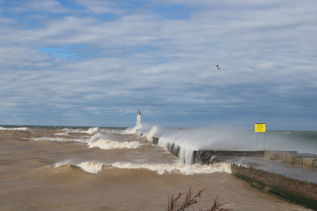
Lake Ontario waves along the breakwall to Sodus Point Lighthouse. Credit: Mary Austerman/NYSG
Contact:
Mary Austerman, NYSG Great Lakes Coastal Community Specialist, E: mp357@cornell.edu, P: (315) 331-8415
The interactive New York Sea Grant Lake Ontario Flood Risk Mapping Tool empowers local leaders’ flood contingency planning
Newark, NY, March 8, 2021 - After record-high water levels in 2017 and 2019, the late winter and early spring water levels in 2020 had Lake Ontario communities questioning whether another flood was on the horizon. Even with advances in weather forecasting, there are still uncertainties in water level forecasting, particularly because of spring precipitation. Visualization tools allow users to see various scenarios for contingency planning and making mitigation decisions.
In 2020, the Village of Sodus Point (Wayne County) used the Lake Ontario Inundation Mapping Tool developed by New York Sea Grant (NYSG) in partnership with Cornell University, to visualize parcel-level flood risk of individual properties in its community. That visualization of inundation scenarios derived from the NYSG mapping tool empowered the Village and its residents in preparedness planning. For example, they identified the location and triage of accessory structures and belongings during high water. Identifying areas prone to inundation informed community-level preparedness planning and marked areas that warranted in-depth analyses.
Flood mitigation decisions for properties in the Village were made in part based on the information the tool provided. The NYSG mapping tool was used sometimes at the homeowners’ requests; other times, based on research done by the Village.
Learn more at www.nyseagrant.org/waterlevel2017.
“This tool has been used by the village and many of the residents to determine what, if anything, needed to be done to secure their property from the ravages of high water. We have found the tool to be easy to use and it provides valuable information to inform resiliency projects.” — Dave McDowell, Mayor, Village of Sodus Point
Project Partner:
• Village of Sodus Point
Note: The National Oceanic and Atmospheric Administration Community Climate Adaptation Initiative provided funding to develop the Lake Ontario Inundation Mapping Tool.
More Info: New York Sea Grant
New York Sea Grant (NYSG), a cooperative program of Cornell University
and the State University of New York (SUNY), is one of 34 university-based
programs under the National Oceanic and Atmospheric Administration’s
National Sea Grant College Program.
Since 1971, NYSG has represented a statewide network of integrated
research, education and extension services promoting coastal community
economic vitality, environmental sustainability and citizen awareness
and understanding about the State’s marine and Great Lakes resources.
Through NYSG’s efforts, the combined talents of university scientists
and extension specialists help develop and transfer science-based
information to many coastal user groups—businesses and industries,
federal, state and local government decision-makers and agency managers,
educators, the media and the interested public.
The program maintains Great Lakes offices at Cornell University, SUNY
Buffalo, SUNY Oswego and the Wayne County Cooperative Extension office
in Newark. In the State's marine waters, NYSG has offices at Stony Brook
University in Long Island, Brooklyn College and Cornell Cooperative
Extension in NYC and Elmsford and Kingston in the Hudson Valley.
For updates on Sea Grant activities: www.nyseagrant.org has RSS, Facebook, Twitter, Instagram, and YouTube links. NYSG offers a free e-list sign up via www.nyseagrant.org/nycoastlines for its flagship publication, NY Coastlines/Currents, which is published quarterly.